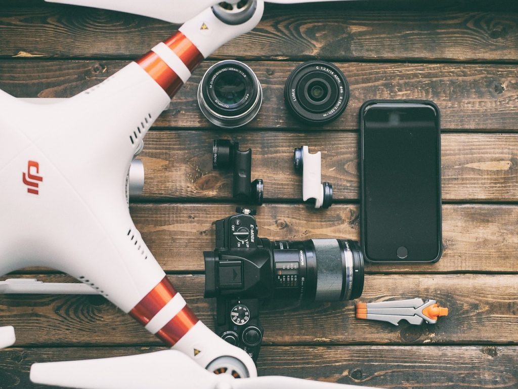
Drone
Insurance
Connect Insurance understand the risks involved when operating unmanned aerial systems (UAS). This includes unmanned aircraft vehicles (UAV) and small unmanned aircraft (SUA) collectively known as drones.
We can secure a competitive quote specifically tailored for the exposure faced by commercial drone users. Our product offerings include UAV Insurance, UAS Insurance, and Drone Insurance for unmanned aircraft deployed for commercial purposes.
Clients have the advantage of consistent communication with the same staff member(s) throughout their policy cycle. We consistently provide a range of insurance products from a panel of insurers to meet the specific requirements of our clients.
Our drone insurance policies will ensure you comply with EU Regulation 785/2004
Benefits of Drone Insurance
Flight Assessment Exam Cover
Public Liability up to £10 million
Damage To/ Loss Of Drone
Associated Equipment Cover
24hr Claims Helpline
In Transit Cover
European Cover
Employer Liability Cover Available
FAQ
What is a Drone?
The term drone is widely used to describe unmanned aerial vehicles (UAVs). A drone is a machine that can fly autonomously with software controlled flight plans, or from a remote control device. Drones come in all shapes and sizes with many features, functionality and optional extras. The drone market is rapidly expanding with constant intuitive additions.
Are Drones Easy to Control?
GPS Position Hold technology is a common feature in the latest consumer drone models. It stabilises the drone’s current location, heading, and altitude, allowing it to essentially “loiter”. This is achieved by locking the three principal axes of flight dynamics (roll, pitch, and yaw). Multi-rotor drones handle this feature better.
Mastering the control of a lightweight drone typically takes two weeks for an operator. First-time drone pilots are encouraged to practice in open spaces, focusing on orientation and operating at safe altitudes. Consumer drones usually have a flight range of 500 to 1000 meters. This range determines the highest altitude before losing RLOS (radio line of sight), leading to loss of control.
When operating a drone, pay close attention to battery size and life. Flight time varies depending on the battery capabilities. A typical consumer drone with a GoPro camera flies for about 25 minutes. Drones with higher lifting capacity deplete their battery faster due to increased power output to compensate for extra weight.
The term “take-off weight” refers to the maximum weight a drone can lift, including itself. For example, a drone weighing 10kg with a take-off weight of 15kg can carry a 5kg payload. Heavy-lift drones are multi-rotor aircraft that can carry a significant payload, often exceeding their own weight. These drones typically have larger batteries and props than consumer “hobby” drones.
What is Drone Insurance?
Drone Insurance ensures that drone operators comply with drone law regulations, preventing criminal prosecution. It also prevents costly claims in the event of public liability. Despite a drone operators best intentions the occurrence of Lost Link can result in costly claims. These are often blamed on the operator’s presumed negligence. Lost Link refers to the loss of command and control link with a remotely-piloted aircraft. If loss of control leads to physical injury to a third party, the costs could escalate astronomically. An extreme example would be loss of sight caused by a rotating propeller hitting someone in the face.
Drone Insurance covers public liability up to £10 million for damage or injury to any third party. It also covers damage or loss to the drone and associated equipment. Employer’s liability cover is available to protect a business’ employees. Drone insurance is also purchasable for the flight assessment exam that commercial drone operators must undertake.
There are very specific compliance regulations for operators of unmanned aircrafts. Any operator of a unmanned aircraft is advised to consult the Insurance Requirements for Air Carriers and Aircraft Operators. This will help them to ascertain the minimum level of insurance required.
Other reference material that may be useful:
2015 Briefing on Civil drones in the European Union
European Aviation Safety Agency – Civil drones (Unmanned aircraft)
European Aviation Safety Agency – Flying a Drone Leaflet
UK Parliament – Civilian Use of Drones in the EU – European Union Committee
Common Questions about Drones:
Drones, intended for various uses, come in different sizes and shapes. They are often categorized as Quad, Hex, or Octo, based on the number of rotors—four, six, and eight, respectively. Additional rotors enhance stability, control ease, and lifting power, crucial for professional photography drones carrying heavy cameras.
Hexacopter and Octocopter Drones possess an advantage: they can still fly if a motor or electronic speed controller (ESC) fails mid-flight. Drones with extra rotors can typically return home, unlike Quadcopters, which may suffer a break in RLOS (radio line of sight), potentially leading to a crash and damage.
Battery Life: Drones typically fly for around 20 minutes before battery depletion. Plan for spare batteries to avoid cutting your flight short.
FPV (First Person View): Essential for videographers and highly recommended for photographers, FPV allows operators to “see” as their drone does, often via a video downlink to an LCD monitor, smartphone, or tablet.
Gimbal: A pivot point enabling rotation, a 3-axis gimbal offers functionality similar to a gyroscope, providing pan and tilt for cameras on drones.
GPS-Based Autopilot: This feature offers smart flight controls, including “follow me” and “auto return to home” functions.
Waterproof: While most consumer drones aren’t designed for rain due to non-waterproofed motors and ESCs reaching high temperatures, some manufacturers offer waterproof models. However, it’s not a typical feature in consumer-level hobby drones.
Is a licence required to fly a drone?
Drones have become mainstream and are widely utilised for professions such as photographers, videographers and site surveyors.
Where a drone is being used for commercial purposes, the law dictates that the operator must acquire ‘Operating Permission’. This ‘Permission to Fly’ is awarded by the CAA (Civil Aviation Authority). If your drone exceeds 20kg in weight when fully equipped, you require a special licence for “Airworthiness Approval”. Again, this comes from the CAA. You can find a range of regulatory and law guidance information in the FAQ menu below.
Where can I fly my drone?
It is important to always ensure you do not fly a drone within 50 metres of any person, vehicle or structure. This includes buildings. Even with the drone in your VLOS (visual line of sight) do not control it over congested areas such as sports events and music festivals. The drone should be operated in large open spaces to ensure there is no danger presented to third parties. Public liability Insurance should be arranged to protect you from claims in the event that an accident does occur.
What commercial use is there for my drone?
Using a drone for commercial purposes is typically in the niche of photography and surveyance. Good examples include wedding photography and the construction industry. Amazon have recently been looking into the potential for using drones as a delivery method in the distribution sector under their service named Amazon Prime Air. Beyond these industries, american company Fly4Me has been subcontracting it’s drone services to commercial sectors such as golf courses, solar panel installers (for roof dimensions and shading data for panel placements), alongside infrastructure inspections. Other commercial sectors currently being considered for the benefits of drone use include mining, farming and agriculture, disaster response and premises security.
Using a Drone for photography?
When operating a drone fitted with a camera or video, you remain aware of the regulations regarding privacy.
The digital age and availability of affordable cameras has resulted in an large increase of adept photographers and videographers. The introduction of drones to the field has resulted in a surge of interest for aerial photography.
Despite many drones boasting their camera-equipped capabilities, not all “off the shelf” solutions are suitable for professional photography. Experts recommend a minimum resolution of 1080p at 60 frames per second for video and 12 megapixels for photos.
What is "Aerial Photography"?
Anything shot from the air, whether it be video or photos can be called aerial photography. In the past the most common Aerial Photography was done from helicopters. Now, thanks to the range of drones on the market, aerial photography is more accessible than ever before.
Which camera drone is best?
There is an old saying: “the best camera is the one that you have with you”. This also applies to camera drones. With a few exceptions the ‘best camera drone’ could be any with suitable features. These would be a gimbal, a decent flight range and some sort of FPV setup.
Can drones be used for seascape photography?
Drones can be used for seascape photography, and for flight over bodies of water. It is essential however that the operator pays attention to the altitude. Sea spray and seawater in general can be very corrosive where any motor or electronics are concerned. As drones are not commonly waterproof, submersion in water should be avoided wherever possible.
Regulations
Standard Drone Law
A brief overview of the basics of UK law and regulation surrounding drone operation:
- You are legally responsible for the safe conduct of each flight.
- Before each flight check that your drone is un-damaged and that all components are working in accordance with the user manual.
- You must keep your drone within your sights at all times.
- You are responsible for avoiding collisions.
- It is illegal to fly your drone over a congested area or airports and airfields.
- Do not fly your drone within 50 metres of a person, vehicle, building, pylon or overhead groups of people at any height.
- Be wary of the use of your images as you may break privacy laws.
- If you are using your drone for commercial activity you must get a permission from the Civil Aviation Authority.
- Obtain liability and damage insurance from us at www.comparedrone.co.uk
To ensure the safety and privacy of others, certain rules and regulations apply to the use of Drones.
Law Resource List
Below is a list of resources that will help increase your awareness about regulatory law surrounding the use of Drones for private or commercial purposes.
- Civil Aviation Authority – The Dronecode
- Civil Aviation Authority – Specific regulations about small unmanned aircrafts.
- Civil Aviation Authority – Guidance on registration and airworthiness approval for unmanned aircraft.
- TNS UK Ltd – Drones Public Dialogue
- Civil Aviation Authority – Requirements for operating in airspace.
- Civil Aviation Authority – Insurance requirements for operators.
- FPV UK – Drone Law Guidance
Air Operator Certificate
The CAA, or Civil Aviation Authority, have structured a qualification that ensures pilots of any aircraft have fundamental understandings of applicable regulations relating to aviation of drones.
The most important regulations for which any pilot should be sufficienty educated on, are the ANO (Air Navigation Order) and also the Rules of the Air Regulations. Any potential pilot will need to demonstrate competence with a ground exam and flight test before operating permission will be issued by the CAA.
Courses in piloting competence for drones are ran by approved commercial National Qualified Entities (NQE’s) on behalf of the CAA. A list of the NQE’s can be viewed here.
UK Air Law
The law often has ambiguous grey areas with blurred lines that confuse even the most articulate of people. The foreward of the ANO actually stipulates that: “It has been prepared for those concerned with day to day matters relating to Air Navigation who require an up to date version of the Orders and the Regulations mentioned above. The Office of the General Counsel of the Civil Aviation Authority edits it. Courts of Law will however refer only to the Queen’s Printer’s Edition of Statutory Instruments.”
The ANO refers to “Air Navigation: The Order and Regulations,” edited by the Office of the General Counsel of the Civil Aviation Authority. Only two articles are really relevant to the use of drones (unmanned aircraft): Article 166 and 167. You can view the contents of these articles below. If you prefer to view the ANO in its entirety, please see here.
Article 166: Small unmanned aircraft
(1) A person must not cause or permit any article or animal (whether or not attached to a parachute) to be dropped from a small unmanned aircraft so as to endanger persons or property.
(2) The person in charge of a small unmanned aircraft may only fly the aircraft if reasonably satisfied that the flight can safely be made.
(3) The person in charge of a small unmanned aircraft must maintain direct, unaided visual contact with the aircraft sufficient to monitor its flight path in relation to other aircraft, persons, vehicles, vessels and structures for the purpose of avoiding collisions.
(4) The person in charge of a small unmanned aircraft which has a mass of more than 7kg excluding its fuel but including any articles or equipment installed in or attached to the aircraft at the commencement of its flight, must not fly the aircraft:
(a) in Class A, C, D or E airspace unless the permission of the appropriate air traffic control unit has been obtained;
(b) within an aerodrome traffic zone during the notified hours of watch of the air traffic control unit (if any) at that aerodrome unless the permission of any such air traffic control unit has been obtained; or
(c) at a height of more than 400 feet above the surface unless it is flying in airspace described in sub-paragraph (a) or (b) and in accordance with the requirements for that airspace.
(5) The person in charge of a small unmanned aircraft must not fly the aircraft for the purposes of aerial work except in accordance with a permission granted by the CAA.
Article 167: Small unmanned surveillance aircraft
(1) The person in charge of a small unmanned surveillance aircraft must not fly the aircraft in any of the circumstances described in paragraph
(2) except in accordance with a permission issued by the CAA.
(2) The circumstances referred to in paragraph (1) are:
(a) over or within 150 metres of any congested area; CAP 393 Section 1: Part 22: Aircraft in Flight
(b) over or within 150 metres of an organised open-air assembly of more than 1,000 persons;
(c) within 50 metres of any vessel, vehicle or structure which is not under the control of the person in charge of the aircraft; or
(d) subject to paragraphs (3) and (4), within 50 metres of any person.
(3) Subject to paragraph (4), during take-off or landing, a small unmanned surveillance aircraft must not be flown within 30 metres of any person.
(4) Paragraphs (2)(d) and (3) do not apply to the person in charge of the small unmanned surveillance aircraft or a person under the control of the person in charge of the aircraft.
(4) Paragraphs (2)(d) and (3) do not apply to the person in charge of the small unmanned surveillance aircraft or a person under the control of the person in charge of the aircraft
CAA Droneaware
You are responsible for each flight; violating rules mandated by the law may result in criminal prosecution.
You bear responsibility for preventing collisions. Endangering the safety of an aircraft in flight is a criminal offense punishable by imprisonment for up to 5 years.
Always maintain visual contact with your drone and keep it below 400 feet in altitude.
While flying, always adhere to your manufacturer’s instructions.
Always remain aware of CAA’s law regarding safe distances from people, crowds and structures. This is 50m in all directions for camera fitted drones.
Ensure that you respect others’ privacy when operating a camera-fitted drone to avoid civil disputes related to harassment or invasion of privacy.
Sources:
ICO: Privacy & Drones
Disclaimer
PLEASE BE AWARE THAT NOT ALL MENTIONED COVER, FEATURES AND BENEFITS ARE PROVIDED AS STANDARD; SOME MAY BE SUBJECT TO ADDITIONAL PREMIUM, OR SUBJECT TO UNDERWRITERS TERMS AND CONDITIONS. IF YOU REQUIRE ANY SPECIFIC COVER, FEATURE OR BENEFIT ON YOUR POLICY, PLEASE ADVISE DURING QUOTING AND ENSURE THAT THE COVER IS INCLUDED PRIOR TO ACCEPTING THE INSURANCE CONTRACT. CONNECT INSURANCE BROKERS LTD ACCEPT NO LIABILITY SHOULD YOU REQUIRE A FEATURE OF COVER DURING THE POLICY DURATION THAT HAS BEEN OMITTED AS A RESULT OF YOUR FAILURE TO SPECIFY IT’S NECESSITY PRIOR TO INCEPTION. PLEASE BE AWARE THAT CONNECT INSURANCE LTD CANNOT GUARANTEE THE SOLVENCY OF ANY INSURER WE USE.